The New Orleans Land Bridge is usually discussed as storm protection.
That makes sense. The marsh between New Orleans East, Lake Pontchartrain, Lake Borgne, the Rigolets, and St. Tammany Parish helps blunt storm surge before it reaches the lake system and the communities around it.
But for Louisiana inshore fishermen, this is not only a flood story.
It is a habitat story.
It is a Rigolets story.
It is a Lake Pontchartrain story.
It is a camp, crab, bait, trout, redfish, marsh, bird, refuge, access, and working-water story.
A state and federal restoration panel is moving toward a roughly $101 million East Orleans Landbridge restoration project that would create and restore about 1,320 acres of marsh habitat and build nearly 15,000 linear feet of shoreline protection. The preferred plan would use sediment dredged from Lake St. Catherine and place it along the land bridge near the Rigolets, the narrow pass connecting Lake Pontchartrain to Lake Borgne and the Gulf.
The broad public purpose is storm protection and wetland restoration.
The local fishing question is more direct:
What happens when the marsh that shapes one of Southeast Louisiana's most important inshore edges is restored, rebuilt, disturbed, and changed?
What the project is
The East Orleans Landbridge project is part of the Deepwater Horizon restoration process. The Louisiana Trustee Implementation Group released a draft Phase 2 Restoration Plan and Environmental Assessment for the East Orleans Landbridge and Raccoon Island restoration projects.
For the East Orleans Landbridge, the preferred alternative would create approximately 1,320 acres of marsh habitat and construct about 14,867 linear feet of shoreline protection. The estimated total cost is about $101.2 million.
The project would use dredged sediment from Lake St. Catherine to build marsh. Public reporting says roughly 5 million cubic yards of sediment would be used. The project is expected to begin next summer, with planting and final work running into 2029.
This is not the first restoration work on the New Orleans Land Bridge. A previous project completed last year restored about 275 acres of marsh along Chef Menteur Highway south of Fort Pike. The broader land-bridge restoration concept is much larger, with Louisiana's Coastal Master Plan pointing toward major long-term investment in the New Orleans East Landbridge area.
This new project is one piece of that larger effort.
But it is a piece that sits directly in a place inshore anglers know.
Why this land bridge matters
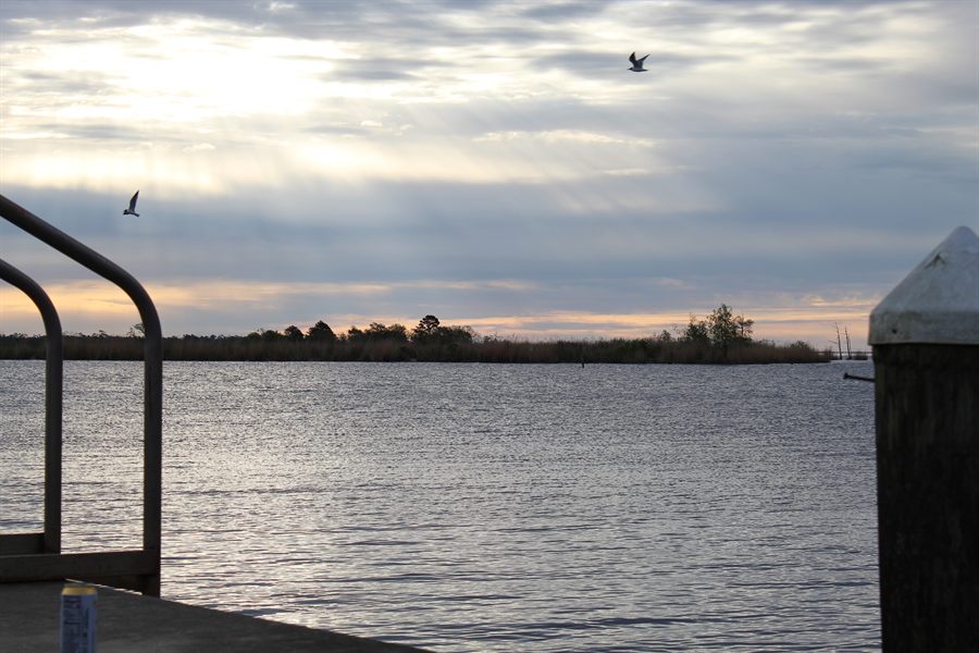
The land bridge separates Lake Pontchartrain from Lake Borgne and the Gulf. It helps control how storm surge, waves, saltwater, and open-water energy move toward the lake.
That matters for flood protection.
It also matters for fishing.
Lake Pontchartrain is not a closed pond. It is part of a large estuarine system connected through the Rigolets and Chef Menteur Pass to Lake Borgne and the Gulf. Water, bait, fish, salinity, sediment, storms, and seasonal changes move through that connection.
The Rigolets is one of the key doors.
Around that door are marshes, camps, passes, shorelines, drains, refuge lands, and routes that matter to anglers and working-water users. People fish those edges for trout, redfish, drum, flounder, sheepshead, bass, crabs, and bait depending on season, salinity, and conditions.
Restoring land there is not only about drawing a green shape on a coastal map.
It can affect how water moves, how waves hit shorelines, how habitat holds together, and how the lake's eastern edge functions over time.
That is why LAInshore.com is treating this as more than a flood-control item.
The good case for the project
The argument for the project is strong on paper.
Louisiana is losing marsh. The land bridge is shrinking. If it weakens further, the Lake Pontchartrain system becomes more exposed to storm surge and wave energy. More open water also means more erosion, fewer protective edges, and less habitat complexity.
Marsh creation can put land back where water has taken it.
Shoreline protection can slow wave-driven erosion.
Native grasses and roseau cane can help hold new sediment in place.
If the project works as intended, the benefits could include more stable marsh edge, better storm-buffering capacity, more habitat for fish and wildlife, more protection for nearby communities, and a stronger natural barrier between Lake Pontchartrain and the Gulf side of the system.
For anglers, more marsh can mean more edge.
More edge can mean more bait, more ambush points, more nursery habitat, more protection from wave energy, and more of the broken, living shoreline that makes Louisiana inshore fishing work.
That does not mean every fisherman will notice a direct benefit immediately.
But healthy marsh is part of the foundation of inshore fishing. Losing it rarely helps.
The practical concerns
The concern side is not imaginary.
Marsh creation requires construction.
Construction means dredges, barges, pipelines, access corridors, turbidity, temporary disruption, possible navigation effects, work zones, noise, closures or avoidance areas, and changes to familiar water.
People with camps nearby may deal with construction traffic or altered routes. Fishermen may lose access to a spot temporarily. Crabbers, recreational anglers, guides, and local boaters may have to work around equipment or changing conditions. Borrow areas in Lake St. Catherine may raise questions from users who know that water as more than a sediment source.
There are also longer-term practical questions.
Will the built marsh hold?
Will shoreline protection change water movement in ways local fishermen notice?
Will sediment placement affect nearby routes or depths?
Will new marsh create usable habitat, or will it be too high, too low, too exposed, or too artificial at first?
Will construction timing collide with seasonal fishing patterns?
Will posted work zones and access restrictions be communicated clearly?
None of those questions mean the project is bad.
They mean restoration is not invisible to the people already using the water.
Why this is different from a sediment diversion fight
The land bridge project also matters because Louisiana is shifting attention after the cancellation of the Mid-Barataria Sediment Diversion.
Mid-Barataria was a massive river-reconnection project. It was designed to move Mississippi River water and sediment into the Barataria Basin. Supporters saw it as one of the few tools big enough to build land at scale. Opponents, including fishing and oyster interests, warned about salinity changes and damage to existing seafood livelihoods.
That project was canceled in 2025.
The East Orleans Landbridge project is different. It is a marsh creation and shoreline protection project using dredged sediment, not a large river diversion that would continuously change basin salinity.
That distinction matters.
For fishermen worried about diversions, dredged marsh creation may look more targeted and less disruptive to basin-wide salinity. For restoration supporters, it may look useful but smaller than the kind of large-scale river reconnection they argue Louisiana still needs.
So this project may avoid some of the most explosive diversion arguments.
But it does not avoid the larger question:
Can Louisiana rebuild enough marsh fast enough with project-by-project construction?
That question remains open.
It is not environmentalists versus fishermen
The lazy version of this story would say restoration groups support the project and fishermen should automatically support it too.
That is not how the water works.
Many fishermen support marsh restoration because they watch land disappear every year. They know what happens when shorelines fall apart, ponds open into bays, and storm surge has fewer barriers. They know that fish, crabs, shrimp, birds, camps, launches, and local communities all depend on marsh.
At the same time, fishermen are often the first to feel the disruption from restoration work.
They deal with pipelines, closures, changed water, construction traffic, temporary muddy water, altered access, and the uncertainty of whether promised habitat will become useful habitat.
A project can be good for the coast and still create problems for people using that coast during construction.
That is the tension worth reporting.
Editor's note: LAInshore.com is awaiting and inviting comment from project officials, restoration groups, local marina or camp owners, and recreational or commercial fishermen who use the Rigolets, Lake St. Catherine, Lake Pontchartrain, or nearby waters. Send relevant comments, documents, or contact information to e.smith@bluecollarmarine.com.
Why anglers should pay attention
Regular inshore anglers should watch this project for three reasons.
First, it sits in a major fishing corridor. The Rigolets and Lake Pontchartrain edge are part of a system many local anglers use, even if they do not think of it as "the land bridge."
Second, it may shape future habitat. Marsh creation does not only protect houses. It changes the water's edge, and the edge is where much of Louisiana inshore fishing happens.
Third, it may show what Louisiana restoration looks like after Mid-Barataria. If the state leans more heavily on dredged sediment, marsh creation, shoreline protection, and smaller or more targeted projects, anglers should understand what those projects can and cannot do.
Dredged sediment can build marsh.
It can also be expensive, limited by borrow material, vulnerable to storms, and dependent on design, planting, and maintenance.
A diversion can move sediment at scale.
It can also change salinity and threaten existing fisheries.
There is no painless tool.
The question is which cost Louisiana chooses, where, and who feels it first.
What to watch next
The first thing to watch is final approval and construction timing.
The public-comment process for the draft restoration plan was open through June 17, 2026. If the project proceeds, construction is expected to start next summer, with planting and final phases running into 2029.
The second thing to watch is access.
Will anglers and local users get clear notices about work zones, equipment, pipeline crossings, navigation restrictions, or temporary closures?
The third thing to watch is the borrow area.
Lake St. Catherine is not just a sediment source on a planning document. It is part of the local water system. Any dredging there should be explained clearly to the public, including where material is removed, how deep, and what local users should expect.
The fourth thing to watch is performance.
How much marsh is actually created? How much survives the first few storm seasons? Does vegetation establish? Do shorelines stabilize? Does the project reduce erosion where it is supposed to?
The fifth thing to watch is whether the project becomes a model.
If Louisiana moves away from big diversions and toward more constructed marsh projects, the East Orleans Landbridge could become part of a larger shift in coastal strategy.
That shift matters to anglers because restoration strategy shapes fishing habitat.
The bottom line
The Rigolets land bridge project is a flood story.
But it is not only a flood story.
It is an inshore habitat story because the land bridge helps shape the Lake Pontchartrain, Lake Borgne, Rigolets, Bayou Sauvage, and New Orleans East edge of Louisiana's fishing map.
The upside is clear: more marsh, more shoreline protection, stronger storm-buffering capacity, and potentially better habitat over time.
The concerns are also real: construction disruption, access changes, borrow-area questions, cost, long timelines, and uncertainty about how built marsh performs in a changing coast.
That is the honest frame.
Louisiana needs marsh. Louisiana also needs the people who use the water to know what is being built, where it is being built, how it may affect them, and whether it works after the ribbon-cutting language fades.
For LAInshore.com, that makes this exactly the kind of story worth following.
Not because every restoration project is automatically good.
Not because every concern is automatically opposition.
Because in Louisiana, the line between flood protection, fish habitat, public access, and working-water life is never as clean as the project map makes it look.
Source record
Sources checked include CPRA's May 26, 2026 notice, the Federal Register notice for Draft RP/EA #8.1, AP/Verite reporting on project timing and sediment volume, and restoration coalition project summaries. The 5 million cubic yards figure is attributed to AP/Verite reporting.
- CPRA: Louisiana Trustees release draft restoration plan for East Orleans Landbridge and Raccoon Island
- Federal Register: Draft Phase 2 Restoration Plan and Environmental Assessment #8.1
- AP: Louisiana land bridge project reporting
- Verite / Louisiana Illuminator: land bridge project reporting
- Restore the Mississippi River Delta: New Orleans East Marsh Creation
Reader Response
Have a local correction, firsthand detail, or respectful response?
Send it to LAInshore.com. Include the article title, what you saw or know, and any source, photo, document, or public record that helps verify it. Useful reader responses may inform corrections, updates, or follow-up reporting.
Send a response